The Editors of Encyclopedia Britannica on the Kilauea Volcano. If you want your tour to focus on this incredibly force of nature join us on one of our Volcano Explorer Tours departing from either Kona or Waikoloa. Sit back and relax.
Kilauea, also called Mount Kilauea, the world’s most active volcanic mass, located on the southeastern part of the island of Hawaiʻi, Hawaiʻi state, U.S. The central feature of Hawaiʻi Volcanoes National Park, Kilauea (“Much Spreading” in Hawaiʻian), is an elongated dome built of lava eruptions from a central crater and from lines of craters extending along east and southwest rifts, or fissures. The volcano’s 4,090-foot (1,250-metre) summit has collapsed to form a caldera, a broad shallow depression nearly 3 miles (5 km) long and 2 miles (3.2 km) wide with an area of more than 4 square miles (10 square km). Kilauea’s slopes merge with those of the nearby volcano Mauna Loa on the west and north.
During the 19th century the main floor of Kilauea’s caldera went through several periods of lava filling and collapse. By 1919 it assumed its present depth of 500 feet (150 metres). The floor, paved with recent lava flows, contains the Halema‘uma‘u (“Fern House”) Crater, an inner crater that is Kilauea’s most active vent. Halema‘uma‘u is the legendary home of Pele, the Hawaiʻian fire goddess. The Hawaiʻian Volcano Observatory is at Uwēkahuna Bluff on the western rim of Kilauea, near Halema‘uma‘u.
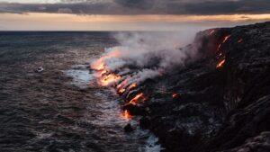
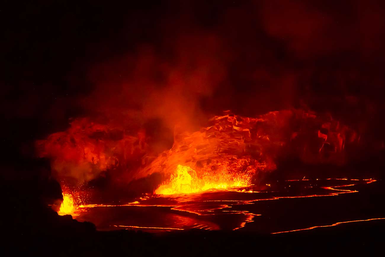
Kilauea’s frequent eruptions are usually nonexplosive and are contained within Halema‘uma‘u as a boiling lake of active lava, which sometimes rises and overflows along the floor and flanks of the caldera proper. In 1790, however, a paroxysmal steam explosion killed part of a Hawaiʻian army marching near the caldera. A less violent eruption in 1924 enlarged Halema‘uma‘u Crater to a depth of 1,300 feet (400 metres). In 1955 an eruption in the east rift, accompanied by a series of violent quakes, was one of the most destructive in the island’s history, with lava pouring from fissures over a period of 88 days, destroying more than 6 square miles (15 square km) of valuable sugarcane fields and orchards. A similar but shorter-lived occurrence in 1975 was followed by a destructive tsunami.
In a series of eruptions that began in 1983 and continued into the early 21st century, Kilauea produced a river of flowing lava that reached the sea 10 miles (16 km) south of the volcano. In 2018 a series of eruptions in the east rift opened several fissures that cut across residential neighbourhoods, releasing lava and clouds of sulfur dioxide gas; one eruption was explosive and sent a plume of volcanic ash some 30,000 feet (9,140 metres) into the air.
Kilauea Iki, a crater directly east of Kilauea, erupted spectacularly in 1959, creating a 400-foot- (120-metre-) deep lake of molten lava and Pu‘u Pua‘i (“Gushing Hill”), a cinder cone near its southern rim. The east rift zone supports numerous pit craters ending in Makaopuhi, with a depth of 1,000 feet (300 metres). Mauna Iki (elevation 3,032 feet [924 metres]), situated 6 miles (9.5 km) from Kilauea on the southwest rift zone, is a low volcanic dome in a desert area.
Kilauea is bordered by Mauna Loa volcano (west and north), the Ka‘ū Desert (southwest), ‘Āinahou Ranch (south), and a tropical fern jungle (north-northeast). The littoral Ka‘ū Desert consists of barren lava, crusted volcanic ash, and moving dunes of windblown ash and pumice 10 to 30 feet (3 to 9 metres) high. The Thurston Lava Tube, a 450-foot (135-metre) tunnel east of the caldera, was formed when a lava stream’s outer crust hardened while the molten lava continued its flow.