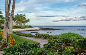
Kaloko-Honokohau National Historical Park, is a historical landmark visited on Kailani Tours Hawaiʻi Coffee, Cloud Forest, and Brewery Tour. Here’s some good information from the National Park Society.
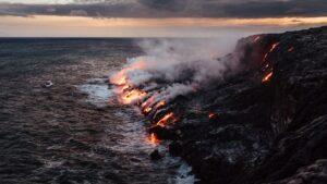
On the Lava Flows the People Discovered a Spirit…
To survive in a hot and arid environment the native Hawaiʻians (kanaka maoli) used ancient fishing skills, including the building of fishponds, and the knowledge of the location of precious fresh water (wai) that flows into the many brackish pools throughout the park. The spirit of the people (poe) and the knowledge of the elders (kupuna) created a tradition of respect and reverence for this area.
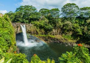
What could’ve been the loss of one of Kamehamehaʻs favorite fishponds became the beginnings of a National Park. This is the story of how a “wahi pana” (a special, celebrated, legendary place) was saved and protected due to the numerous natural and cultural resources and the many dedicated cultural practitioners and community members. This is the story of how the people “touched the spirit and felt its mana”. Today the park is a cultural “kipuka” for Hawaiʻians, a place of cultural and spiritual significance.
People
| As desolate as the barren lava landscape at the park may appear, the people who lived in Kaloko-Honokohau developed a system of working and living in balance with their environment. Life was not easy, fresh water was scarce and food was harvested from the sea and aquaculture ponds. These products would be traded with extended family living in the uplands for other required staples such as taro, breadfruit and paper mulberry. The ahupua’a consisted of land extending from the mountains to the sea and included all the necessary items for survival. This system still forms the basis for many land and resource management policies throughout the state of Hawai’i today. Kaloko Fishpond The stone walls extending into the crashing surf mark the boundaries of Kaloko Fishpond. This is a loko kuapa, where the stones are dry stacked without the use of mortar to enclose the mouth of a small bay. At Kaloko Fishpond, walls were angled to diffuse the energy of the powerful ocean waves while allowing new sea water to penetrate through the porous lava rocks and circulate about the fishpond. A large sluice gate (makaha) allows for further water exchange with the pond and prevents larger fish from escaping. Fishponds are among the great engineering feats of Hawaiʻians, nowhere else throughout Polynesia were fishponds so numerous and highly developed. Current efforts are underway to once again enable Kaloko Fishpond to be managed and used for aquaculture. Aimakapa Fishpond Today, Aimakapa fishpond is famous as a refuge for many native and migratory wetland birds. Looking back in time, Aimakapa Fishpond was a loko pu’uone. This type of pond consists of a large water area trapped behind sea dunes. A channel was dug from the pond to the ocean to allow for water circulation and exchange. Aimakapa Fishpond was used to raise fish for the ali’i (chiefs) and is thought to be over 600 years old. Aiopio Fishtrap Dark lava rocks rise up from the waters of Honokohau Beach. They are the remnants of the Aiopio Fishtrap, built by Hawaiʻians to capture fish. An opening in the trap to the sea enabled fish to enter, and the walled sections of the trap allowed fish to be stored until needed. At high tide, fish entered the trap by swimming through the seaward opening or over the submerged walls. At low tide, the fish were trapped in the enclosure and were easily netted. Fishtraps differ from fishponds in that the fish are trapped and caught, but not raised. ‘Ai’opio Fishtrap Wall The ‘Ai’opio Fishtrap is a 1.7-acre pond, consisting of a stone and coral wall forming an artificial enclosure along a naturally curving shoreline. The fishtrap had a variety of uses well into recent history, and it remains as a material signature of native Hawaiʻians’ interactions with the sea. Over time, the wall has slowly collapsed. The NPS Submerged Resources Center comprehensively mapped the seawall as an initial measure in restoring the fishtrap wall. |